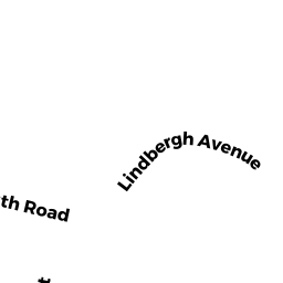
16 LINDBERGH AVE
Owner Information
BAILEY CRAIG J
16 LINDBERGH AVE
AMESBURY, MA None


Property Details
16 LINDBERGH AVE is classified as a Single Family Residential (Cape cod).
The primary structure on this property was built in 1978. There are 5,269ft2 of built area within this property. There is 2,829ft2 of residential/living space within this property. This property is listed as having 7 rooms.
16 LINDBERGH AVE is valued at $584,000. The land is valued at $217,000 and the structures are valued at $344,800. There is an additional valuation of $22,200 on this property.
This property is in Zone R8. Confirm with local Zoning Board authorities to ensure there are no overlays or other easements on this property.
The most recent deed for 16 LINDBERGH AVE is recorded at the local registrar in Book 35981, Page 1. 16 LINDBERGH AVE was last sold on Thursday, June 29, 2017 for $1.
Assessment data from fiscal year 2022.
Flood Data
According to the FEMA National Flood Hazard Layer, this property does not appear to be in a flood zone. It may also be in an area not yet reviewed. Nonetheless, confirm this information prior to taking any action.
To view the flood hazards around this property, create a FEMA "Firmette" Map of the area around 16 LINDBERGH AVE.
Broadband Internet Providers
| Provider | Type | Bandwidth (mbps) | |
|---|---|---|---|
| XO Communications | Copper Wire | 0 | 0 |
| Viasat Inc | Satellite | 100 | 3 |
| Verizon New England Inc. | DSL | 15 | 1 |
| Comcast | Cable | 1000 | 35 |
| T-Mobile | Fixed Wireless | 25 | 3 |
| GCI Communication Corp. | Satellite | 0 | 0 |
| HughesNet | Satellite | 25 | 3 |
| VSAT Systems, LLC. | Satellite | 2 | 1 |
Broadband service provider data from December 2020.
Adjacent Properties
- 12 LINDBERGH AVE
Two-Family Residential owned by BRADLEY ANNA F LIFE ESTATE - 14 LINDBERGH AVE
Single Family Residential owned by MAZZAGLIA DARREN M - 22 LINDBERGH AVE
Single Family Residential owned by SANFORD MILDRED K WILKINS - 193 LIONS MOUTH RD
Improved, Education (Municipal or County) owned by AMESBURY CITY OF - 141 FRIEND ST #R
Vacant, Conservation Organizations (Charitable Org.) owned by ESSEX COUNTY GREENBELT ASSOC, INC.